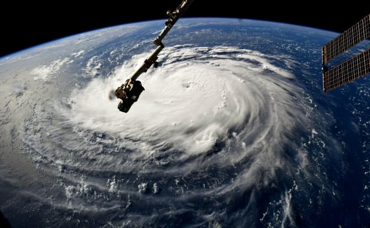
Hurricane Florence is headed for the Carolinas. The storm is so powerful that it could be a category 6 hurricane, say experts. NASA has now released a 3-minute video shot from the ISS, showing the scale of the monster Hurricane from space and it is fearsome.
While the footage itself seems almost serene and calm, the sheer size of it is most definitely a cause for concern. The International Space Station passed directly over the eye of the storm, which NASA named as a category 4 for now. The storm has a diameter of over 643 km, says the space agency and the National Hurricane Center sent out a warning on 12 September- "Dangerous Florence heading toward the U.S. Southeast coast and is expected to bring life-threatening storm surge and rainfall to portions of the Carolinas and Mid-Atlantic States."

The storm is one of the biggest in recent history, and NASA says that it could cause a storm surge as high as 13 feet. On 12 September, the Visible Infrared Imaging Radiometer Suite (VIIRS) on NASA-NOAA's Suomi NPP satellite made an infrared view of Florence and the eye of Florence remained distinct, notes the report. The VIIRS imagery also showed how the overall structure has become more symmetric than it was.
The eyewall has the coldest cloud top temperatures and the strongest thunderstorms, surrounding the open eye. Cloud tops are found to be colder than minus 62.2 Celsius, says NASA. These regions are surrounded by powerful storms whose cloud tops reached temperatures as low as minus 56.6 degrees Celsius.
NASA says that cloud top temperatures that exceed 53 degrees C are known to produce heavy rainfall. Florence, as can be seen, has a wide storm where the cloud tops get colder than threshold temperatures, indicating that it has can generate excessive rainfall covering a large area.
Florence has been recorded moving west to the northwest near at a pace of about 28 kph and this movement is expected to continue. A slight turn toward the northwest is forecast to continue through Thursday.
The National Hurricane Center has live updates on all hurricanes in the region.


