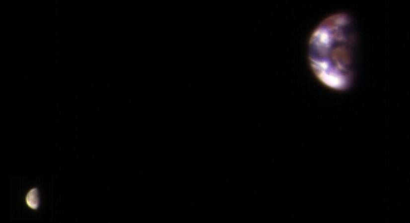
NASA has released an image of Earth and its Moon as seen from Mars. The image, which was taken using the most powerful telescope on November 20 last year, shows continent-size details of the planet and the relative size of the moon.
The image was taken by High Resolution Imaging Science Experiment (HiRISE) camera on NASA's Mars Reconnaissance Orbiter to calibrate HiRISE data, since the reflectance of the moon's Earth-facing side is well known. The image combines two separate exposures, but they were processed separately to effectively show all details visible on Earth and Moon. Moon is comparatively darker than Earth and would barely be visible if shown at the same brightness scale as Earth.
The reddish feature close to the middle of the face of Earth is Australia, while Antarctica is the "bright blob" at the lower-left. South East Asia also appeared as a reddish area at the top of Earth, NASA said. The other bright areas in the image are clouds.
Mars was about 205 million km away from Earth when the images were taken.
"The combined view retains the correct positions and sizes of the two bodies relative to each other. The distance between Earth and the moon is about 30 times the diameter of Earth. Earth and the moon appear closer than they actually are in this image because the observation was planned for a time at which the moon was almost directly behind Earth, from Mars' point of view, to see the Earth-facing side of the moon," the space agency said.