Vancouver-based tech company, UrtheCast Corp has been recognised as the Fastest Growing Tech Company in Canada by Deloitte's 2016 Technology Fast 50.
UrtheCast, a well-known name in the Earth observation industry, have created four Earth Observation sensors that capture earth imagery in medium- to high-resolution formats, the data is then fed to ground stations for storage and secure distribution, allowing its customers to accurately track changing weather conditions and topography.
Brendan Johnston, UrtheCast's General Manager, Platform and Analytics told International Business Times: "Something very special is happening right now in Canada's tech sector — we're in an industry that is absolutely thriving. To receive this distinction recognizing UrtheCast as being the fastest growing technology company in Canada in this highly competitive and successful environment is a true honor and reinforces our belief that we here at UrtheCast are onto an opportunity that is clearly very unique."
UrtheCast recently teamed up with National Aeronautics and Space Administration (NASA) to improve earth observation imagery.
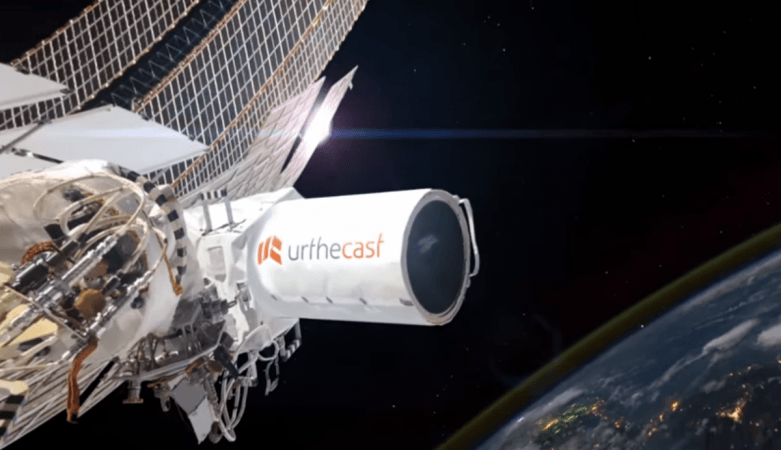
Johnston explained, "UrtheCast and NASA collaborate to deliver NASA's High Definition Earth-Viewing System (HDEV) feed which showcases a spectacular view of the Earth's limb as the planet rolls beneath the International Space Station.
"This view is delivered from several sensors attached to the ISS and is made available to the public at urthecast.com/live. The video is captured from the External Payload Facility of the European Space Agency's Columbus module from cameras that are enclosed in a pressurized, temperature-controlled casing."
This Canadian organization stands out in the crowd, by offering public access to their earth imagery.
UrtheCast also offers a variety a cost-efficient options based on the customers' needs. The unique capabilities of UrtheCast and geospatial analytics is explained by Johnston: "Tackling some of the world's biggest problems requires massive amounts of high quality, objective data that is easily accessible in a scalable manner and that is compatible with the needs of organizations performing advanced analytics using machine learning and artificial intelligence.
"UrtheCast provides exactly this with our satellite-based sensor systems – some of the most diverse in the industry. They allow for deeper, quicker, smarter analysis and the creation of actionable insights.
"Between the UrthePlatform — which houses three UrtheCast sensor datasets in addition to those of the USGS's Landsat 8 and ESA's Sentinel-2 — and our highly responsive Customer Experience team, we've opened that diverse system for developers, businesses, and governments alike to integrate multiple sources of geospatial data. Industries that regularly make use of this data for geospatial analysis include high-tech precision agriculture, forestry, insurance, and disaster relief, amongst others."
This organization caught the eye of Deloitte when they registered a revenue spike of 72,938% within a 3-year time-span from 2012 to 2015.
Black Knight Decoded shot from outer space with the UrtheCast camera on the International Space Station
UrtheCast continues to innovate in the field of geospatial analytics; Johnston cited their plans for the future. "We aim to continue designing our planned UrtheDaily and OptiSAR satellite constellations," he told International Business Times.
"UrtheDaily is being designed to comprise eight satellites that are planned to image the Earth's entire landmass, every single day, at a spatial resolution of five meters, allowing us to objectively and consistently monitor and measure change and the pulse of our entire planet, daily.
"OptiSAR is designed to use UrtheCast's ground-breaking radar technology to image the Earth's surface any time of day, in any weather condition, with unprecedented clarity and ease of use."