Severe cyclonic storm 'Yaas' has moved north-northwestwards with a speed of about 10 kmph over the past six hours and lay centred on early Tuesday over east central and adjoining west central Bay of Bengal.
The cyclone is near latitude 18 degree north and longitude 88.6 degree east, about 320 km south-southeast of Paradip, 430 km south-southeast of Balasore, 420 km south-southeast of Digha and 470 km south--southwest of Khepupara, said the Tropical Cyclone Advisory of Regional Specialised Meteorological Centre of India Meteorological Department (IMD).
It is very likely to move north-northwestwards and intensify further into a very severe cyclonic storm during next 12 hours, the advisory forecast.
The cyclone is expected to continue to move north-northwestwards, intensify further and reach northwest Bay of Bengal near North Odisha and West Bengal coasts very close to Chandbali-Dhamra Port by May 26 early morning.
"Yaas is very likely to cross North Odisha-West Bengal coasts between Paradip and Sagar Islands around Balasore during May 26 noon as a very severe cyclonic storm."
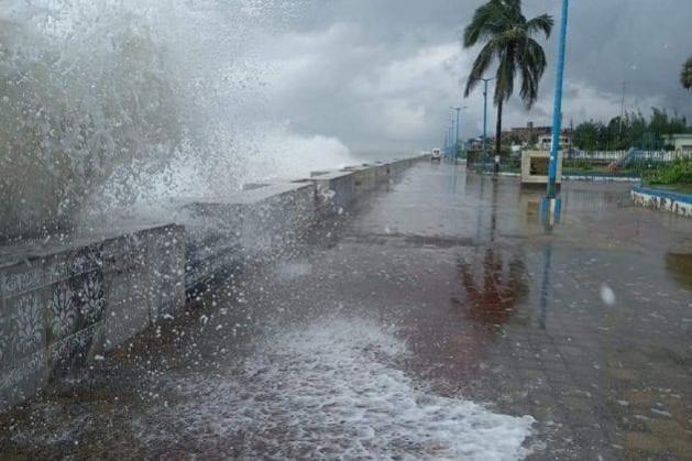
The maximum sustained wind speed of the cyclone is estimated 55 knots gusting to 65 knots around system centre. Sea condition is rough to very rough and the estimated central pressure is 982 HPA (Hectopascal Pressure Unit).
"At 0000 UTC (Universal Coordinated Time), a buoy near 16.3 degree north or 88 degree east reported maximum sustained wind of 240 degree or 35 knots and mean sea level pressure of 993 HPA.
"As per satellite imagery based on 0000 UTC of May 25, the clouds are organised in curved band pattern. Intensity of the system is characterised as T 3.5. Broken low and medium clouds with embedded intense to very intense convection lay over the area between latitude 12.5 degree north and 19.5 degree and 82 degree east and 90 degree east. Minimum cloud top temperature is 93 degree central," said the advisory.
"The Madden Julian Oscillation (MJO) index currently lies in Phase 5 with amplitude near 1. Thereafter, it will move across phases 6-8 with amplitude less than 1. MJO is conducive for enhancement of convection over the Bay of Bengal (BoB) on Tuesday," said the advisory.
The Tropical Cyclone Heat Potential (TCHP) is over major parts of Bay of Bengal, and it is slightly decreasing over extreme north and along and off Andhra, Odisha, West Bengal coasts.
Northeast on Alert
Cyclone 'Yaas' is likely to affect three northeastern states - Assam, Meghalaya and Sikkim - causing moderate to heavy rains on May 26-27, IMD officials said on Monday. IMD officials said that the intensity of rain depends on the cyclone movements.
Assam Chief Minister Himanta Biswa Sarma, in a tweet, said : "Cyclone 'YAAS' is likely to affect the (northeastern) region on 26-27 May. Hon'ble UHM Amit Shah called and enquired about preparedness of Assam, Sikkim and Meghalaya.
"Informed that emergency services have been pressed into action. Grateful, to Hon'ble UHM for his continued concern for the region." IMD Director in Tripura Dilip Saha said that light to moderate rain is likely to occur in many states of the northeastern region.
"In few places in the region might witness heavy rain. However, the rain and wind speed of the Cyclone 'Yaas' would depend on the strength and direction of the storm," Saha told IANS.
Meanwhile, in view of latest advisory of the IMD, eight teams of the National Disaster Response Force (NDRF) in Guwahati were airlifted to Odisha for search and rescue operations. NDRF 1st Battalion Commandant H.P.S. Kandari said that the Odisha government had requisitioned more than 50 teams of the NDRF while West Bengal governemnt requested 35 teams. Teams from NDRF battalions in Assam and Bihar are being airlifted to Odisha and West Bangal in addition to those from the battalions stationed in these states.
The teams consisting 200 personnel including engineers, paramedics, technical experts were airlifted from Lokapriya Gopinath Bordoloi International Airport in Guwahati to Biju Patnaik International Airport in Bhubaneswar by Indian Air Force transport aircraft. These teams are equipped with flood rescue boats, collapse search and specialist rescue equipment.