Track Live Coverage of Cyclone Hudhud Landfall Here
Cyclone Hudhud: How You Can Stay Safe; Helpline Numbers 011-26107953, 09711077372
HUDHUD HELPLINE NUMBERS Andhra Pradesh
| AP Secratariat, Hyderabad | 040-23456005, 040-23450419 |
| Srikakulam | 08942-225361, 9652838191 |
| TOLL FREE | 1800-4256625 |
| Vijayanagaram | 08922-278770/236947 |
| Vishakapatnam | 0891-2563121 |
| TOLL FREE | 1800-425-00002 |
| East Godavari | 0884-2365424/2365506 |
| TOLL FREE | 1800-4253077/4251077 |
| West Godavari | 08812-230050/230934/252655 |
| TOLL FREE | 1800-4258848 |
— ADG PI - INDIAN ARMY (@adgpi)
12 October
3.30 pm: Five people have reportedly been killed as Cyclone Hudhud lashed coastal areas of Andhra Pradesh and Odisha.
1.45 pm: Three people were killed as Cyclone Hudhud made landfall in the port city of Vishakhapatnam.
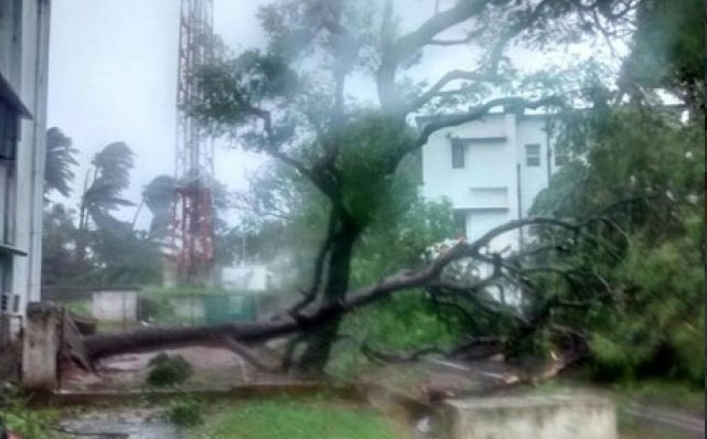
"Three deaths have been reported due to the impact of Hudhud cyclone. Two died after trees fell on them and one in collapse of compound-wall in Visakhapatnam and Srikakulam districts, respectively," Andhra Pradesh Chief Secretary I V R Krishna Rao told Press Trust of India.
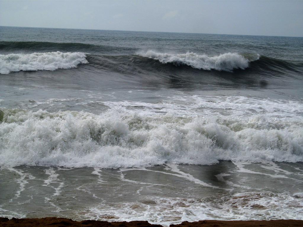
12.05 pm: The eye of the cyclone is crossing Vishakhapatnam and hence rains have abated there. Waves have risen up to 1 to 1.5 meters.
The second wall cloud will again bring heavy rains and winds, says IMD. The storm will become weaker by 50 % after six hours. Rains, however, will continue for the next few days, proceeding up to Jharkhand, Chattisgarh, Madhya Pradesh, Bihar and West Bengal.
In Odisha, the winds are not very strong now (60-70 km per hour), but it will soon get very heavy rains in several southern districts, says IMD at a press conference.
12.02 pm: The two deaths reported in AP were due to heavy rains felling trees and walls. A man was reportedly killed when a tree fell on him while a woman was illed when a wall collapsed on her.
11.45 am: Windspeeds have now dropped to 180 km per hour
While there may be a short lull of a few hours in the storm, it is expected to pick up speed and intensity again after two hours as the tail of the storm will hit the coast.
11.30 am: As Cyclone Hudhud makes landfall, heavy rains lash Vishakhapatnam and other parts of Andhra Pradesh, as well as in Odisha.
11.15: Two killed in rain-related incidents in Visakhapatnam and Srikakulam districts under the influence of severe cyclonic storm Hudhud: Andhra Pradesh government, says a PTI update
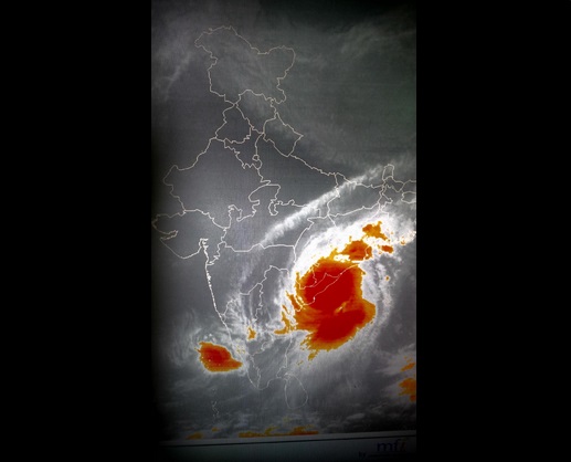
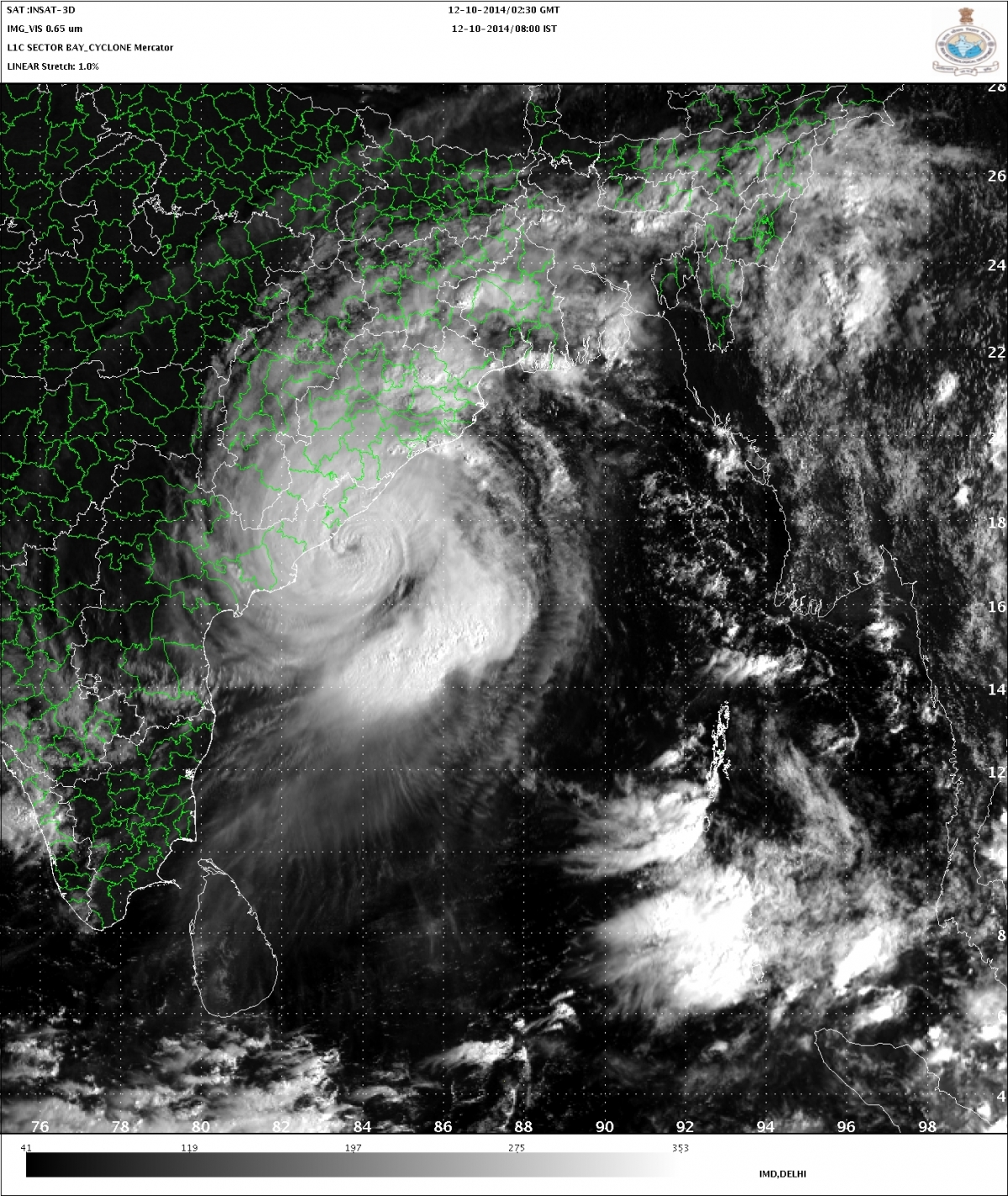
11.00 am: Cyclone Hudhud has made landfall. The eye of the storm has reportedly crossed Vizag. Windspeeds have reached about 200 km per hour, almost as strong as that of Cyclone Phailin.
Cyclone hudhud hits outskirts of vizag city pic.twitter.com/0Bq3Lnkz3N
— mahabharat_forever (@sohoniD) October 12, 2014
10.40 am: Cyclone Hudhud makes landfall as edge of the storm has crossed Vizag. Eye of the storm only 20 km away from coast.
10.30 am: The leading edge of the eye of cyclone Hudhud is reportedly crossing Vizag. Sea conditions have turned 'phenomenal', according to the IMD.
IMD has sent out a RED MESSAGE to the goverment authorities over the 'Very Severe Cyclonic Storm', which it said was 60 km away from Vishakhapatnam at 9.30 am.
10.20 am: The cyclone is expected to make landfall before noon, and could make impact in a little over an hour. Wind speeds will be as high as 195km per hour
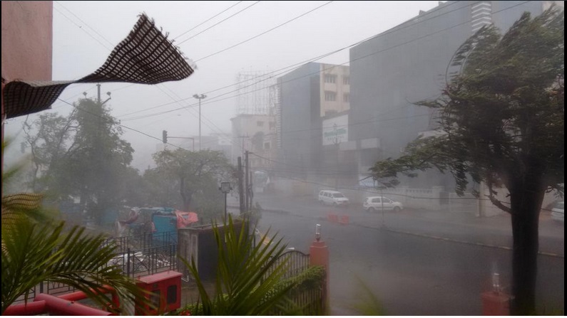
Visuals from Vizag in the wake of #CycloneHudhud pic.twitter.com/4v5nFFDpe1
— ANI (@ANI_news) October 12, 2014
9.30 am: The cyclone is now 40 km away from the port city of Vishakhapatnam.
Communication lines in the city have been disrupted.
9.00 am: The cyclone is reportedly 60 km away from Vishakhapatnam. More than 4 lakh people have been evacuated in Andhra Pradesh and Odisha. The cyclone has reached windspeeds of 180 km per hour. In Vishakhapatnam, winds are already blowing at 125 km per hour
8.30 am: The cyclone is reportedly about 70 km away from Vishakhapatnam. Strong winds and rains are wreaking havoc in the port city, and the National Highway has been blocked.
Ferocious Cyclone Hudhud Named after Israel's National Bird Hoopoe
The Indian Army, Navy and Airforce have been kept rescue teams on stand-by. 17 Coast Guard Ships, nine aircraft, 44 teams of the National Disaster Response Force with over 2,000 rescuers have been deployed for rescue operations.
8.00 am: More than 2 lakh people have been evacuated with only three hours left before Cyclone Hudhud, which has turned into a very severe storm, makes landfall near Vishakhapatnam.
11 October
4.00 pm: More than one lakh people have been evacuated from the coastal districts of Andhra Pradesh in preparation for the cyclone.
CYCLONE LOCATION: The cyclone is 260 km southeast of Visakhapatnam and 350 km south - southeast of Gopalpur, as per an update by IMD at 2.30 pm. The speed of Cyclone Hudhud has increased to 165km per hour, as per reports.The wind speed would gradually increase to 170-180 kmph gusting to 195 kmph around the time of landfall, according to IMD.
According to IMD, even after landfall, Cyclone Hudhud would maintain the intensity of very severe cyclonic storm for 6 hours and gradually weaken into a cyclonic storm in subsequent 6 hours while moving northwestwards across south interior Odisha and Chattisgarh. Under its influence rainfall at most places with heavy falls at a few places would occur over south Chattisgarh, adjoining Telangana and south Odisha and isolated heavy to very heavy falls over north Chattisgarh and north Odisha.
1.30 pm: Prime Minister Narendra Modi has called for a meeting to review preparedness for Cyclone Hudhud. With new data revealing that the wind speeds during the cyclone could reach up 185 km per hour, which will only be a little short of Cyclone Phailin's impact last year which reached up to 220 km per hour, rescue efforts and evacuation have been intensified.
As many as 24,000 people were shifted from Visakhapatnam district, 15,000 from Vizianagaram and 46,000 from Srikakulam and 160 from East Godavari district so far, special commissioner, state disaster management authority, K Hymavathi told Press Trust of India.
The Andhra Pradesh state government has requested the Indian Space Research Organisation (ISRO) to provide satellite pictures of the coastal region to speed up rescue efforts.
CYCLONE LOCATION: The cyclone is 350 km southeast of Visakhapatnam and 390 km south - southeast of Gopalpur. The speed of Cyclone Hudhud has increased to 165km per hour, as per reports. It could reach up to 185 km per hour before it makes landfall on Sunday.
12. 30 pm: Cyclone Hudhud could intensify and peak up to a deadly 185 km per hour before it makes landfall on Sunday, much higher than the 140-150 km per hour estimated earlier.
This finding was revealed by NASA, after its Aqua satellite passed over Hudhud, as reported by IANS.
The data also said that the cyclone has a potential of dropping very heavy rainfall, as the cloud top temperatures were as cold as -53 degree Celsius.
Cyclone Hudhud has been upgraded to a "very severe cyclonic storm" by the India Meteorological Department, which sent out a 'Orange Message', a higher level of warning, to the Centre and to the states on Friday.
1500 NDRF personnel have been deployed in Andhra Pradesh and Odisha, while the Navy has kept relief teams and ships on stand-by.
The Andhra Pradesh government will evacuate up to 4.56 lakh people from the coastal villages of east and west Godavari, Visakhapatnam, Vizianagaram and Srikakulam districts by Saturday evening ahead of the landfall, according to The Times of India.
The Odisha government is also set to evacuate 3.5 lakh people from affected regions.
CYCLONE LOCATION: "The Severe Cyclonic Storm 'HUDHUD' over west central Bay of Bengal moved northwestwards and intensified into a very severe cyclonic storm. It lay about 470 km east-southeast of Visakhapatnam and 520 km south-southeast of Gopalpur. The system would move west-northwestwards and cross north Andhra Pradesh coast around Visakhapatnam by the forenoon of 12th October 2014," the IMD has said in its bulletin.
Railways Cancels Several Trains:
The Railways has cancelled many trains and diverted the route of several others -
The East Coast Railway (ECoR) has cancelled 35 trains running between Bhubaneswar and Visakhapatnam route from Sunday morning. The cancelled trains are - 18463-Prasanti Express, 18411-Bhubaneswar-Vishakhpatna Inter City, 12845-Bhubaneswar-Yashwantpur Express, 17015-Bhubaneswar-Secunderabad Vishakha Express, 18401-Puri-Okha Express, 22871-Bhubaneswar-Tirupati Express, 17479-Puri-Tirupati Express, 11020-Bhubaneswar-Mumbai Konark Express, 22859-Puri-Chennai Express. Other trains such as Tirupati-Puri Express, Vishakha Express, Prasanti Express, Vishkhapatanam Express also stand cancelled from Vishakhpatanam.
Source - IBNLive
10 October
5.00 pm: The Indian Navy has readied teams of personnel for relief and rescue operations as cyclone 'Hudhud' approaches the Andhra Pradesh and Odisha coasts, a navy official told IANS on Friday.
30 diving teams of 10 personnel each ready with inflatable Gemini crafts and associated equipment have been kept on stand-by at the naval base at Vishakhapatnam.
"Medical teams with requisite medical equipment, four helicopters and two fixed wing aircraft are also on stand-by," he said.
The navy has also kept ready three diving teams at Chilka lake in Odisha while two teams are at Kolkata.
4.30 pm: CYCLONE LOCATION
As per the latest update by the IMD at 2.00 pm, the cyclone is 500 km east-southeast of Visakhapatnam and 550 kmsouth southeast of Gopalpur.
The sea condition will turn very rough from Saturday morning and will gradually become 'phenomenal' from Sunday morning along and off north Andhra Pradesh coast and very rough to high along and off south Odisha coast, according to IMD.
Very heavy rainfalls are expected to lash several parts of Andhra Pradesh and Odisha from Saturday.
According to IMD, heavy (6.5–12.4 cm) to very heavy falls (12.5–24.4 cm) at a few places and isolated extremely heavy falls (≥ 24.5 cm) would occur over west and east Godavari, Visakhapatnam, Vijayanagaram and Srikakulam districts of north Andhra Pradesh and Ganjam, Gajapati, Koraput, Rayagada, Nabarangpur, Malkangiri, Kalahandi, Phulbani districts of south Odisha will begin from Saturday.
12:40 pm: CYCLONE LOCATION:
As per the latest update by the IMD at 11:30am, the cyclone is 530km east-southeast of Visakhapatnam and 570km south-southeast of Gopalpur.
12:25pm: Home Minister Rajnath Singh said the Centre was taking stock of the preparedness for the storm.
"Spoke to the chief ministers of Odisha, Andhra Pradesh and Telangana regarding their preparedness to face the fast approaching cyclone 'Hudhud'," the home minister said in a tweet.
"Assured the CMs all help from the centre. The centre is monitoring the progression of 'Hudhud' expected to hit the coast in the next 24 hrs," he added.
CYCLONE LOCATION:
UPDATE 8am: Cyclone Hudhud will further intensify into a very severe cyclonic storm during the next 12 hours, according to the latest bulletin by the India Meteorological Department (IMD) which has been addressed to the Prime Minister's Office. Cyclone Hudhud will cross the north Andhra Pradesh coast around Visakhapatnam by the forenoon of 12 October.
Cyclone Location: The Severe Cyclonic Storm lay about 590km southeast of Visakhapatnam and 610km south-southeast of Gopalpur at 8am on Friday, according to the IMD. It will continue to move west-northwestwards.
9 October
UPDATE: Cyclone Hudhud, which is expected to reach the northern part of Andhra Pradesh's coast on 12 October, may have a smaller range of impact, according to new information by the India Meterological Department.
"On Wednesday we had said that the range for hitting would be between Gopalpur (Odisha) and Vishakapatnam. Now this has been narrowed to nearing Vishakapatnam. The speed would remain the same as of now," IMD director general LS Rathore was quoted as saying by Hindustan Times on Thursday.
Cyclone Location:
On Thursday, the cyclone was about 750km southeast of Visakhapatnam, according to IMD. The system would continue to move west-northwestwards, intensify further into a Severe Cyclonic storm during next 12 hours and into a Very Severe Cyclonic storm during subsequent 24 hours.
Cyclone Hudhud Batters Andaman & Nicobar, Turns into 'Severe Cyclonic Storm'
'Very Severe Cyclonic Storm'
Cyclone Hudhud, which is fast hurtling towards the Indian coast after crossing the Andaman and Nicobar Islands, has the potential to intensify into a 'very severe cyclonic storm' by the time it hits land on Sunday, according to the India Meteorological Department (IMD).
"The system (cyclone) would continue to move West-Northwestwards, intensify further into a Severe Cyclonic storm during next 12 hours and into a Very Severe Cyclonic storm during subsequent 24 hours," an IMD bulletin said.
According to the IMD's Cyclonic Warning Division, the landfall will be in the range of 200km (between Visakhapatnam and Gopalpur) and could be the size of up to 500km. Cyclone Hudhud was formed after a deep depression emerged in the North Andaman Sea, which turned into a cyclonic storm.
The cyclone is expected to bring a heavy rainfall with it, and the regions of Visakhapatnam, Vijayanagaram, and Srikakulam districts of northern coastal Andhra Pradesh are expected to be lashed by rains from Saturday.
As the cyclone moves closer, winds are expected to touch a speed of 70km per hour on Saturday and could go higher than 140km per hour on Sunday, when it will make landfall.
Damage Expected:
According to the IMD, the cyclone could wreak severe damages across the coastal region, especially to kutcha houses. It could also cause partial disruption of power and communication lines, and could also throw rail and road traffic out of gear. One of the bigger potential threats that IMD has identified is from flying debris caught in the strong winds.
Flooding is expected in the region and alerts have already been sent out.
How You Can Stay Safe:
The weather body has advised fishermen not to venture into the sea over the next few days. It has also recommended 'Judicious regulation' of aviation, navigation, rail and road traffic. People in affected areas where the cyclone could fall have been advised to remain at safe places around the landfall period.
Odisha, Andhra Pradesh on High Alert
Odisha, which faced Cyclone Phailin last year, is now bracing for Cyclone Hudhud. "We have asked 16 districts, including all our coastal areas, to remain alert and stay prepared to meet any eventuality," PK Mohapatra, an Odisha relief official, told Reuters.
24-hour emergency control rooms have also been set up. Also, 500 cyclone shelters have been readied and emergency stocks of food have been prepared.
The Andhra government has placed local authorities on high alert in nine of 13 districts, and have readied two months' buffer stocks of food items.
The National Disaster Response Force (NDRF) has also sent two battalions to Andhra Pradesh and Odisha with 12 teams in each battalion.
A Year after Cyclone Phailin
Cyclone Phailin had struck Odisha about the same time last year, when it made landfall on 12 October, 2013. It had reached a speed of 220km per hour, but fortunately, casualties were minimised, thanks to adept steps taken by the state, which had seen a deadly devastation in the 1999 cyclone that had killed 15,000 people.
The United Nations had lauded the Odisha's government's work as a "landmark success story in disaster management."


