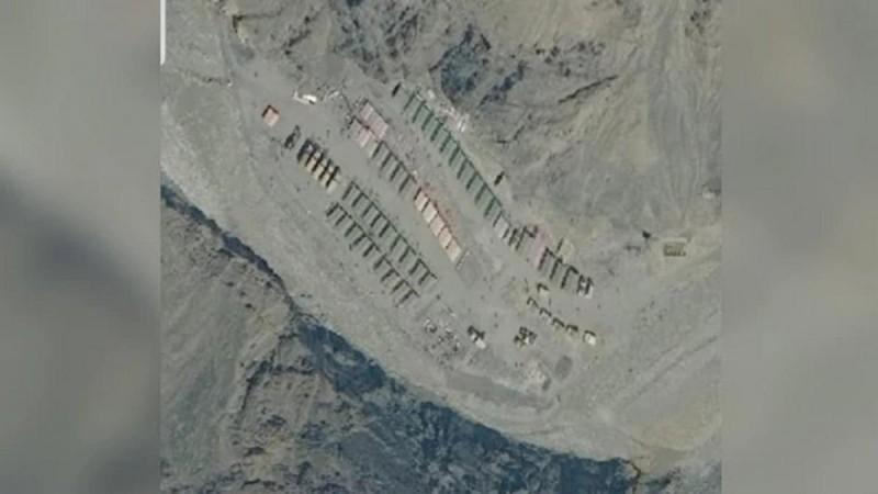
Amid raging border dispute with India, the Chinese military has reportedly created a scaled model of Ladakh. One of the largest scale models in the world was constructed by the People Liberation Army (PLA) at their HelanShan training area.
Since small scale models are created for operational and training purposes, experts believe the motive behind such a big model of an Indian territory could be constructed for conducting war exercises.

The development has come at a time when India and China are locked in a bitter standoff in the remote and picturesque Himalayan region of Ladakh. While both countries have claimed that be on the right direction in resolving the dispute, some experts believe this is the worst border dispute India had since Kargil with Pakistan in 1999. The Kargil resulted in a small scale war between India and Pakistan.
There are fears that the ongoing Indo-Sino border dispute at the Pangong Tso lake in Ladakh could also result in all-out combat between two of Asia's most powerful countries. The construction of a large scale model of Ladakh by the Chinese PLA also points in this direction. In addition to this, China has also moved additional 5,000 troops near the Ladakh border.
What does it mean?
According to a senior officer in India's Border Security Force, Ladakh is a high altitude area and it requires a huge amount of planning to fight a war in such regions. The scale model is an exact replica of that region based on measurements. "These models are created to pre-plan things. Whether the infantry would be able to scale the height or how much time it will take to reach from one particular point to another," he said.

Although India also keeps such scale models for training purposes, he said, scale models, this big are created to plan attack and defence and for that, you need to know the ground details. "If China has created this model, we have to see what could be there purpose. This could be for war or if they need to move their troops in the future, they would need details of the area," he said.
'Engaged with China to peacefully resolve the dispute'
Meanwhile, the Indian government has said that diplomatic efforts were on to peacefully resolve the border dispute with China. Ministry of External Affairs (MEA) spokesperson Anurag Srivastava said that India and China were engaged both at the military level as well as at the diplomatic level to resolve the issue. His remarks came after US President Donald Trump offered to mediate.
"Our troops have taken a very responsible approach towards border management and strictly followed protocols. They scrupulously follow the guidance provided by our leadership. At the same time, we will defend our sovereignty and territorial integrity," he added.


