
The Indian Space Research Organisation (ISRO) has taken a number of steps by which it can now provide early warnings for cyclones, floods, rain, landslides and other natural calamities across the country, which should help save a lot of lives and property, besides triggering timely and efficient governmental response to ensure that the areas and people affected recover from them quickly.
Union Minister of State for Atomic Energy and Space Dr Jitendra Singh, in a written reply to a question in the lok Sabha on Wednesday, said: "ISRO is working on systems to forecast the natural disasters that could be used as input by states and disaster management agencies." He then went on to explain how this would work:
1. Flooding: Singh said in the reply: "The North Eastern Space Applications Centre (NESAC) of ISRO has developed the Flood Early Warning System (FLEWS) as a research and development (R&D) project in Assam in association with the Assam State Disaster Management Authority (ASDMA). The FLEWS model is being used in all 25 flood-prone districts of Assam."
He added: "Another model for forecasting floods in the Godavari floodplains in Andhra Pradesh has been developed by the National Remote Sensing Centre (NRSC) of ISRO. The methodology is being used by the Central Water Commission (CWC). ISRO is developing similar systems for Krishna, Brahmani-Baitarani, Ghagra, Gandak, and Kosi rivers."
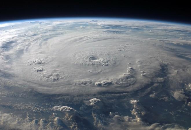
2. Cyclones: The minister said in the written reply: "ISRO has developed methodologies for forecasting cyclone formation, it's track and intensity using satellite based observation. The methodology developed has been transferred to India Meteorological Department (IMD), which is mandated for cyclone forecast."
3. Heavy rain or cloudburst: ISRO's Space Applications Centre (SAC) has "developed a model, for heavy rainfall and cloudburst alerts, which is being experimentally carried out for Indian region," said Singh. The information is made available on ISRO's Meteorological and Oceanographic Satellite Data Archival Centre (MOSDAC) website.
4. Landslides: Singh also talked of an "experimental early-warning system for rainfall-triggered landslides" that has been developed "for use along the pilgrimage-route corridors leading to Gangotri, Badrinath and Kedarnath as well as along the Pithoragarh-Malpa route in Uttarakhand." He explained that warnings as part of this stem are "generated based on the statistical relation between the terrain (geological, morphological) and temporal (primarily long term rainfall events) factors."
5. Extreme weather events: These are basically events that have not been classified in the above categories, and can include extreme heat, extreme cold, sandstorms, duststorms and the likes. Singh said in his reply: "ISRO has developed experimental methodologies for early warning extreme weather events such as heat wave using numerical weather predictions. The information derived is being made available on the MOSDAC website."


