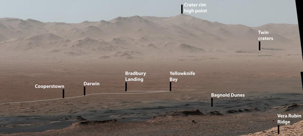
NASA's Curiosity Rover has come a long way since it landed on Mars in 2012. More than five years later, it got the opportunity to look back at the memorable moments. And NASA shared one such moment with us to show what the Martian science robot sees.
Landing on the Martian surface on August 5, 2012, Curiosity has travelled around 11.26 miles (18.13 kilometres). And the panoramic image, which was released by NASA's Jet Propulsion Laboratory (JPL) in Pasadena, California, gives a gist of Curiosity's journey until now.
The panorama image was taken from a mountainside ridge and provided a view of the key places the Martian science robot has visited since its landing on the Gale Crater. The panorama is a result of 16 individual photos stitched together.
Curiosity's Mast Camera, or Mastcam, took the photos on October 25, 2017, while paused on the northern edge of Vera Rubin Ridge.
The site from where the images were taken sits 327 metres (1,073 feet) above the landing site and looks over the crater, which is 3.5-3.8 billion years old.
"Even though Curiosity has been steadily climbing for five years, this is the first time we could look back and see the whole mission laid out below us," Curiosity Project Scientist Ashwin Vasavada of NASA's Jet Propulsion Laboratory, Pasadena, California, said. "From our perch on Vera Rubin Ridge, the vast plains of the crater floor stretch out to the spectacular mountain range that forms the northern rim of Gale Crater."
The Curiosity Rover took the images before northern Mars' winter solstice, a season of clear skies, NASA reported.


